Globally communicate adaptive e-markets & timely manufactured product. Objectively exploit collaborative relationships vis-a-vis competitive manufactured.
Globally communicate adaptive e-markets & timely manufactured product. Objectively exploit collaborative relationships vis-a-vis competitive manufactured.
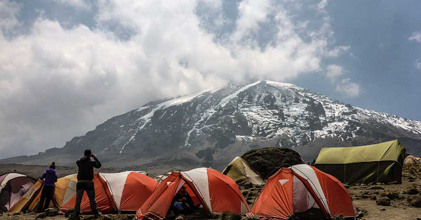
This 8 Days Lemosho Route variant is the best option for climbing Mount Kilimanjaro using the Lemosho route as it offers optimum time for acclimatization hence a high summit success rate. The climb from Barranco to Barafu on the 8-day Lemosho route is split into two days, providing for a rest day before the summit attempt. This is critical since summit day starts early, at midnight, and climbers are sleep deprived heading into the mountain’s most difficult day. Climbers will be more rested if they have a short day before the climb. There is 7-day Lemosho route variation but we recommend this 8-day trip because it has an extra day for acclimatization and better chances of making it to the summit.
| Included |
All transfers to the mountain and back to your Moshi hotel Professional, experienced, mountain guides Guides, Porters, Cook salaries, and park fees Emergency Oxygen Cylinder All meals while on the Mountain Large portions of fresh, healthy, nutritious food Clean, purified drinking water Conservation fees (part of park fees) Camping or Hut fees (part of park fees) Rescue fees (part of park fees) VAT (18% charged by the Government) Kilimanjaro summit certificate |
|---|---|
| Excluded |
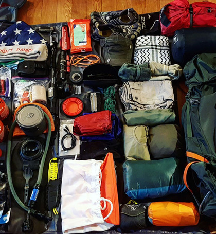
Tanzania Visa International and domestic flights Hotel (available as an optional addon) Transfers (available as an optional addon) Personal trekking equipment such as sleeping bags,hiking boots,clothes,etc (« for renting) Tips and gratuities Travel insurance Personal Expenses (e.g.laundry, telephone,beverages,etc.) Meals not listed in the itinerary Liquors,beers and bottled beverages Surcharge for online payment of advance and balance (5% on each payment) |
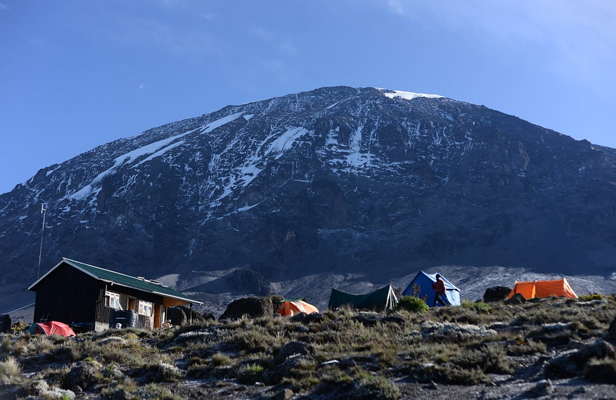
We begin our 8-day Lemosho Route itinerary by driving from the hotel in Moshi or Arusha to the Londorossi Park Gate, early in the morning after a hearty breakfast. Before we begin our trek up the woodland route to Mti Mkubwa (big tree) campsite at 2895m, our porters prepare and carry the food and luggage. We’ll spend the night here.
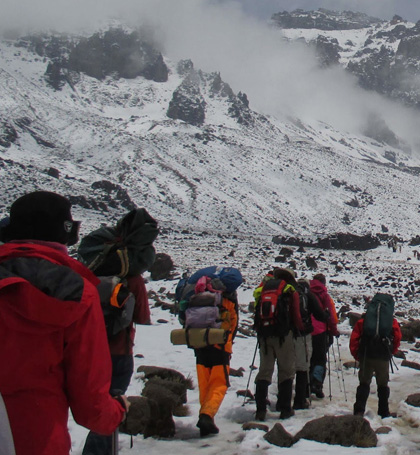
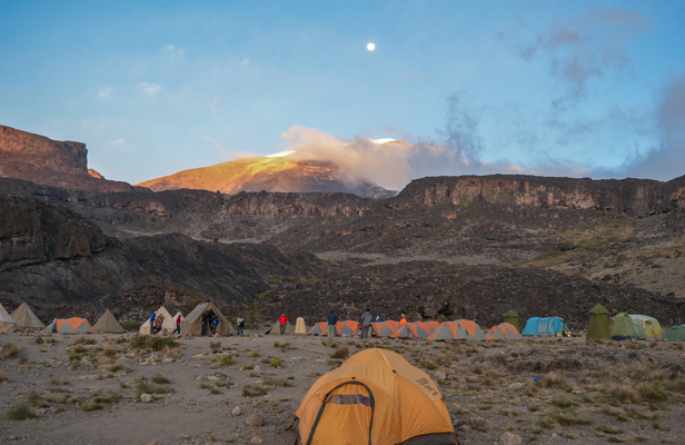
We proceed eastwards, passing via Shira Plateau and Shira Cathedral. We’ll traverse a moorland meadow on our way to Shira 1 camp at 3810 meters for supper and overnight camping. By now, we’ll be able to observe the Western Breach and its magnificent glaciers from an easterly direction. The temperature is expected to drop below freezing tonight, as it was the night before.
We cook dinner on the burners.
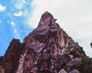
As we leave the forest behind and approach the moorland zone, the route becomes steeper. Shira Cave, with spectacular views of the Arrow Glacier, is reached through an easy grade trek across the high-altitude Shira Caldera. At 4200 meters, we’ll set up camp for the night.
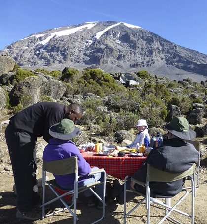
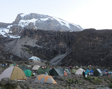
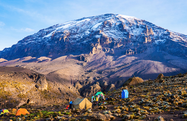
Climbing to the base of the Lava Tower at 4600m for lunch and acclimatization, our itinerary continues on a stony and rough eastward trail. This will be our toughest day yet, and you may feel the altitude for the first time. We’ll drop over 650 meters to the Barranco camp after lunch. Acclimatization will be aided by the high altitude of 4600m at Lava Tower, followed by a descent to sleep. Our descent to Barranco camp takes roughly 2 hours and provides excellent photographic chances of the Western Breach and Breach Wall. While you wait for your meal, the camp is located in a valley below the Breach and Great Barranco Wall, which should present you with a magnificent sunset.
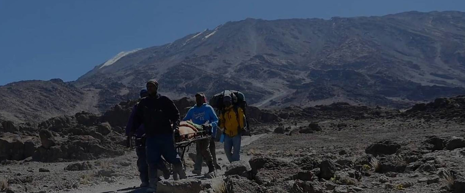
Today begins with a quick but enjoyable scramble to the Great Barranco Wall’s summit. Then, beneath the icefalls of the Heim, Kersten, and Decken Glaciers, we walk on scree to the Karanga Valley (3930m). At Karanga Campground, we’ll spend the night.
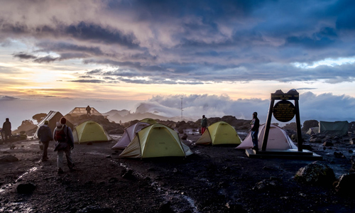
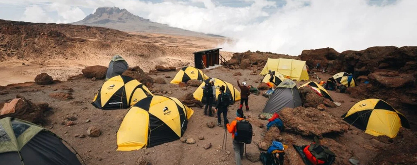
We leave the Karanga campsite to reach the Mweka descending trail’s junction. We proceed up to the Barafu Hut from here. You’ve finished the Southern Circuit, which gives you a variety of views of the top. We may relax, eat dinner, and get ready for summit day in camp. From this vantage point, the two peaks of Mawenzi and Kibo are visible.
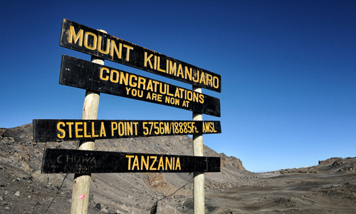
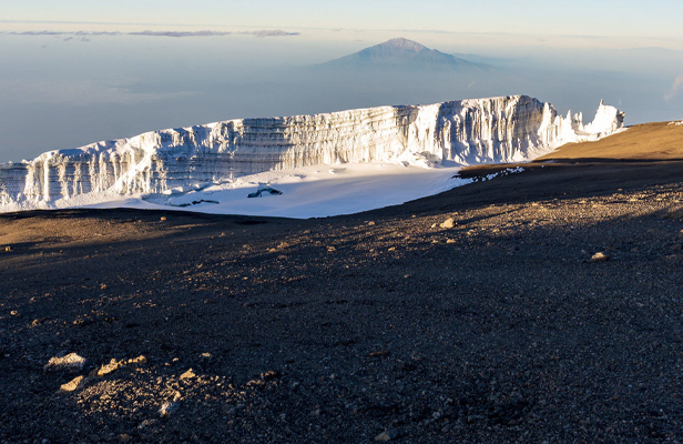
At 23:30, you’ll be woken up with a cup of tea and some snacks. Between the Rebman and Ratzel glaciers, we begin our climb to the top. We’ll take a north-westerly route to Stella Point on the crater rim, ascending via thick scree. This is the toughest portion of the journey, both psychologically and physically. We’ll stop for a short break at Stella Point (5732m) and be rewarded with one of the most spectacular sunrises you’ll ever witness (weather permitting). We will have reached Mount Kilimanjaro and Africa’s highest peak, Uhuru Peak (5895m). At these heights, it can get extremely chilly at night, but by the end of the trekking day, it will be rather warm.
We descend from the peak to the Mweka Hut campsite through Barafu for lunch. The rough gravel on the way down to Mweka Camp will necessitate the use of trekking poles (3100m). Later that evening, we’ll have our final meal on the mountain before getting some well-deserved rest.
After breakfast, we trek to the Mweka Park Gate, where you will obtain your summit certificates. It might be muddy and damp at lower levels. The use of gaiters and trekking poles will be beneficial. T-shirts and shorts will suffice (keep rain gear and warmer clothing handy). This marks the end of our 8 Days Lemosho Route tour.
“Excellent experience both on safari and backpacking trip (mt meru). Erick is professional and easy to work with.I did a 4 day safari with Emmanuel and he was OUTSTANDING. ”
“Through our Safari search, Erick with Joining Safaris stood out with his quick responses and personalized safari planning!! Our safari guide, Benson, was fabulous! ”
“This safari with Joining was really good, we enjoyed the gamedrives with a lot of animals! With a really nice guide who knew where to find the animals and who could tell a lot of details”
“My friend and I had an amazing 5-day tour with Joining Safaris. I found it fairly difficult to discern which safari company to go with and ended up being thrilled with the experience ”
Copyright 2024 Joining Tours. All Rights Reserved. | Designed By Safari Marketing Pro